


Central Europe glaciers
Glaciers are found in the European Alps, the Pyrenees, and the Caucasus Mountains. Central Europe has the greatest number available of length change and mass balance measurements, with many long-term data series.
In Central Europe, almost two-thirds of the perennial surface ice cover is located in the Alps with Aletsch Glacier as their greatest valley glacier. The Alps represent the ‘water tower’ of Europe and form the watershed of the Mediterranean Sea, the North Sea/ North Atlantic Ocean, and the Black Sea. The highest peak is Mont Blanc, at 4 808 m asl, near the Italian-French border. About onethird of the region’s ice cover is represented by glaciers in the Caucasus Mountains which are situated between the Black Sea and the Caspian Sea. Most glaciers are located in the northern part known as the Ciscaucasus with Mount Elbrus (5 642 m asl) considered as the highest peak in Europe. Some smaller glaciers are found in the Pyrenees – a mountain range in southwest Europe. It extends from the Bay of Biscay to the Mediterranean Sea. The glaciers are situated in the Maladeta massif in Spain with the highest peak of the Pyrenees, Pico d’Aneto (3 404 m asl), and around the peak Vignemale (3 298 m asl) in France. A few more perennial ice fields are found e.g. in the Appennin, Italy, as well as in Slovenia and Poland. In the densely populated Alps, glaciers are a unique resource of freshwater for domestic, agricultural, and industrial use, an important economic component of tourism and hydro-electric power production, but also a source of natural hazards. One of the largest historical glacier disasters occurred in 2002 in North Ossetia, in the Caucasus. An ice-rock avalanche in the Kazbek region resulting from a slope failure sheared off almost the entire Kolka Glacier and devastated the Genaldon valley, causing the death of about 140 people (Huggel et al. 2005). In the Alps as well as in the Pyrenees and in the Caucasus most glaciers reached their LIA maximum towards mid 19th century (Gross 1987, Maisch et al. 2000, Grove 2004). Annual observations of glacier front variations started in the second half of the 19th century in Austria, Switzerland, France and Italy resulting in more than 680 data series, distributed over the entire Alpine mountain range. There are over 40 front variation series available for the Caucasus, mostly starting in the 2nd half of the 20th century and a few going back to the 1930s. There are two glaciers in the Pyrenees with length change data, one starting in the 1980s and a second one covering the 20th century, though with a few observation points. Mass balance measurements started in 1949 in the Alps, in 1968 in the Caucasus, and in 1992 on Maladeta Glacier in the Pyrenees. Overall mass balance data is available for 43 glaciers, with 10 continuous series since 1968.
|  |  |
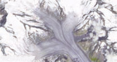
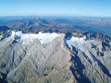 Maladeta-Massif Maladeta-MassifAerial view toward the Maladeta Massif, Spain, with Pico d’Aneto (left), Aneto Glacier (center) as well as Maladeta Glacier (right) from September 2002. Source: M. Arenillas, Ingeniería 75, Spain. | 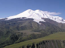 Mount Elbrus Mount ElbrusMount Elbrus, seen from the north (photograph taken in September 2007). Source: A. Kääb, University of Oslo, Norway. | 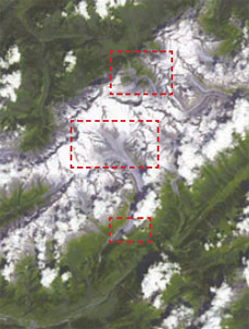 | Bernese Alps with Grosser Aletsch Glacier in the center, Swiss Alps. Source: ASTER satellite image (32 x 44 km) and close-ups, 21 July 2006. | |||
| Bernese Alps | ||||||
 Bernese Alps Bernese Alps | 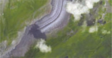 Bernese Alps Bernese Alps | 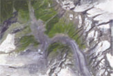 Bernese Alps Bernese Alps |
